|
|
| Subj: |
Re: Asteroids Incoming |
| Date: |
12/17/00 10:51:26 AM Pacific Standard Time |
From: (Frank
Condon)
|
| File: |
Mvc-029f.jpg (38155 bytes) DL Time (TCP/IP): < 1 minute |
Hi Cinde:
The magnets in the local Rancho Cucamonga, CA (Fontana Trend) area have
been slipping again since last Monday. I see a small seismic event to the
SE of Ontario. Maybe it's a part of what's affecting the field changes near
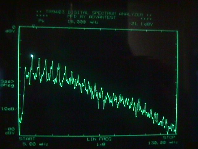
there? Right now we've got the strangest set of harmonics in the ULF
range
that I've ever detected before. They start at 10 mHz and progress upwards
in frequency with 5 mHz increments. I wonder if they're doing some
kind of
EMF weapons testing at (Coso) China Lake?
(see the attached .jpg file)
Yeah, the Garlock is just like a ticking time-bomb. When it goes the other
major faults have a chance to play catch-up with the accumulated strain
released from there. Also, this most recent event is crossing the major barrier
between tectonic
and volcanic zones. Could a plume of magma be coming southward from the
Coso Range towards Ludlow, CA?
You'll notice that I've had the White Wolf fault near Tehachapi, CA on a
seismic watch since December 11, and that's adjacent to the Garlock fault
zone.
I sure wish the "Earthwaves" Quake Meter page would get its act together
before we miss some important results. Maybe they could post the raw data
in a file so that I could see if there was any correlation with the
geomagnetic field changes we're seeing around here?
The asteroid that I've heard they are talking about is Near-Earth Asteroid,
4183 Cuno, which will pass by Earth on December 22nd.
So, you still have plenty of XMAS shopping time left before the suggested
impact date!
C-Ya
Frank Condon
Geo-Seismic Labs
http://www.geo-seismic-labs.org
At 12:48 PM 12/17/00 -0500, you wrote:
>Hi Frank,
>
>Jeeze! Monday? And I don't have all my Christmas shopping
done yet! <g>
>Well, if they wanted to scare us, this would do it. I hope Bush
has a good
>defense plan for nudging asteroids. The article didn't mention
which NEA is
>closely approaching Monday, and a quick check of my NEO links didn't
reveal
>anything incoming for that soon. Do you think the U.S. is keeping
this hush
>hush to avoid some sort of panic this close to Christmas?
Another
>possibility is that the researchers are trying to drum up funding for
the
>seriousness of this most important project, so they threw in that tidbit
of
>"as soon as Monday," to get the benefactors
attention.
>
>I'm watching with keen interest the recent activity in Trona on the east
end
>of the Garlock Fault. Out there in "The Zone", anything could be
brewing.
>Our seismic activity lately seems to be (remotely?) connected to
the
>eruptions of Popo, which has had "unprecedented" seismic activity this
week.
>Subterranean magma connection? Or is it the forces of the tail
wagging the
>dog?
>
>Take care,
>Cinde
>
>In a message dated 12/17/2000 3:07:37 AM Pacific Standard
Time,
>FrankCondon@Geo-Seismic-Labs.org writes:
><< HI Cinde:
> Here's another one of those scare the heck out of us all
scenarios!
>
>
http://www.themoscowtimes.com/stories/2000/12/16/003.html
>
> C-what-U think and let me know.
>
> Frank >>
|
|
| Subj: |
the OWL and the ECSZ... |
| Date: |
12/17/00 11:03:45 AM Pacific Standard Time |
From: (David
Goble)
To: bardsquill@aol.com
|
hi Kent...
i sent you the url for my website...but...so far...i
have not received any response...
by way of explantion...here are some prefatory
remarks...
leading edge tectonics...
the Olympic Wallowa Lineament (OWL) is a NW-SE trending
shear zone that crosses the Cascade Mountains and the Columbia Plateau...appears
in the aeromagnetic data as a co-linear set of gravity
anomalies...and...represents a fundamental crust boundary...
the Seattle Fault (SF) appears as an E-W trending
set of banded gravity anomalies...and...is probably an extension of the
OWL...
the Devils Mountain Fault (DMF)...Darrington Fault
(DAR)...Whidbey Island Fault (WIF)...are also probably extensions of the
OWL...
shearing of the Pacific Plate (PP) against the North
American Plate (NAP) causes induced shear and extension in the Basin &
Range province...
the OWL is the northern exit zone for induced Basin
& Range shear...via the San Juan Fault (SJF)...to the co-linear Queen
Charlotte Fracture Zone (QCFZ)...
this NW directed shear is probably distributed from
the OWL...along the set of faults...SF...WIF...DAR...DMF...
the Brothers Fault Zone (BFZ) is probably the central
exit for induced Basin & Range shear...
the Walker Lane Belt (WLB) is probably the southern
exit zone for induced Basin & Range shear...via the Tahoe-Almanor Graben
(THAG)...to the co-linear Blanco Fracture Zone (BLFZ)...
thus...strain energy partitioned from the San Andreas
Fault (SAF) to the Eastern California Shear Zone (ECSZ) near the Salton Sea
due to the locked "Big Bend" section of the SAF is propagated into the Basin
& Range...and exits this branch extension of the East Pacific Rise (EPR)
via shear back to the main branch of the EPR...
at the present time...the ECSZ accommodates about
25% of the relative motion between the Pacific and North American tectonic
plates by means of this shunt path of the bifurcated spreading center and
transform system...
it is a matter of conjecture whether or not this
alternate shunt system will continue to accomodate more and more of the PP-NAP
relative motion...but...if the Landers and Lavic events are any indication...it
seems probable that it will do so...and...California will not "fall into
the ocean" as the sensational press characterized the
situation...but...instead...will be surrounded by ocean...
what is not a matter of conjecture is that this strain
energy shunt system exists...
look at the documentation...see for yourself...
*****************************
i originally posted this on May Day...1998...my first
post on SYZYGY...
the website was posted over a year later...
epr - May 01, 1998 at 10:51:10 (128)
Two problem areas are immediately evident regarding
the current tectonic setting of the North American Plate (NAP)/Pacific Plate
(PP)/Farallon Plate (FP) boundaries: (1) on land, portions of the PP appear
to move relative to the NAP by large and sudden displacements separated by
long periods of strain energy accumulation. Presently, it appears that strain
energy equivalent to approximately eight meters of restrained motion has
accumulated along the Pleito Thrust section of the San Andreas system since
the Fort Tejon earthquake of 1857 (an estimated Richter magnitude of eight-plus),
(2) the FP is composed of exceptionally young, hot, buoyant material (especially
the southern Humboldt section) and the Cascade Trench has probably been
differentially locked since the Miyako/Otsuchi Tsunami of 1700 (an estimated
Richter magnitude of nine). If so, strain energy equivalent to approximately
twelve meters of restrained motion has accumulated along significant portions
of this subduction zone. Eventually, a system that will most efficiently
relieve the accumulated strain energy (the energy accumulated between the
adjoining plates due to restrained motion) and accommodate movement between
the PP and the NAP will probably evolve by the opening to the East Pacific
Rise (EPR) and the detachment of the leading edge of the NAP from the core
of the continent. The obvious choice for the specific location of the crack
initiation process would be the formation of a spreading center along an
axis through Bishop, California; i.e., along the long axis of the Owens Valley.
Bishop is located at the head of a 120-mile long earthquake belt and is adjacent
to Long Valley Caldera, which has experienced an upward deformation of nearly
a meter in the past twenty years. It is proposed that further evolution of
the opening process would be the formation of a spreading center along the
Owens Valley axis and up through the Carson and Humboldt sinks, the Alvord
Desert, Jordan Volcano, and down into the depths of Hells Canyon (the deepest
gorge on the NAP at 7,900 feet).
regards...