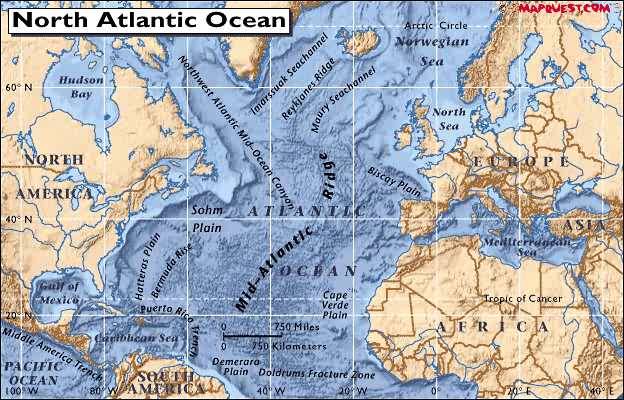
REYKJANES RIDGE activity
4/1/02 7:15:03 AM Pacific Standard Time
Two days worth, every 3-5 hours? North Atlantic map attached -- look like
east of Canada
Harvard, Hockley & San Juan show them on seismos.
I've been reading an interesting article that I pulled off the web about
how most of us have been round this bend before. (See also book,
Catastrophobia). Deep down we remember the devastation. Which
is why everyone is panicky today. Plato said the Atlanteans were at war
with the Athenians at the time Atlantis disappeared -- maybe blasted
into the MAR. Hapgood's theory, I think.
It may have been nukes that did us (Atlanteans?) in even then, because
our present radiocarbon dating is definitely all screwed up, as it would
be if excessive radiation remained behind. There is excessive radiation
even today in the Great Lakes region. Could have been solar; could have
been nukes. We all know about vimanas...
Some leads I want to follow up on on this... For now, is Atlantis
Rising?
2002/04/01
07:12:38.1 54.5N 33.1W 33
Mb4.6 A LDG REYKJANES
RIDGE
2002/04/01
02:15:16.2 54.6N 33.9W 33
Mb4.5 A LDG REYKJANES
RIDGE
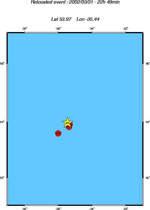
2002/03/31 22:49:13.3 54.0N 35.4W
33G Mb4.9 A MIX REYKJANES
RIDGE
2002/03/31 22:49:12.6 53.8N
35.4W Ms5.0 M GSSC
REYKJANES
RIDGE
2002/03/31 22:49:12.0 53.6N
36.0W M 5.2 A INGV
REYKJANES
RIDGE
2002/03/31 22:42:29.0 53.9N
35.3W 33G Mb5.1 A NEIA REYKJANES
RIDGE
2002/03/31
19:08:16.4 53.4N 30.8W 33 Mb4.9 A
LDG NORTHERN MID-ATLANTIC RIDGE
2002/03/31 19:07:52.2 54.3N
35.1W Ms4.4 M GSSC
REYKJANES
RIDGE
2002/03/31
19:07:49.7 54.0N 35.3W 33G Mb5.1
A MIX REYKJANES
RIDGE
2002/03/31 19:07:49.3 53.8N 35.3W
33G Mb5.0 A NEIA REYKJANES
RIDGE
2002/03/31 19:07:22.7 53.6N
41.0W M 5.0 A INGV
NORTH ATLANTIC
OCEAN